Tuesday, 5 September 2023

Notes on the use of a Jordan drogue

NOTES ON THE USE OF A JORDAN DROGUE

 In 2015 I bought a Jordan-type series drogue for my 35ft gaff cutter Iron Bark II. She displaces 11 tonnes fully loaded so the drogue was 97m long with 124 cones. The leader and first section of drogue was 19mm double-braid nylon and the tail section 14mm double braid.

 In the following three years I sailed from Scotland to Labrador and did a circumnavigation via the southern capes with stops in Western Australia, New Zealand, the Antarctic Peninsula, Falkland Islands and Ireland.  I deployed the drogue a total of 11 times on this voyage, all in the Southern Ocean. Here is what I learned along the way.


Deployment

The Jordan series drogue is attached to the boat by a bridle that is led to either strong posts well aft or chain plates attached to the stern quarters. These attachment points need to be able to take a strain equal to about half the vessel's displacement. Iron Bark II is steel so providing adequate strong posts on the stern quarters was simple. A GRP vessel will probably use chain plates, which will be of similar dimensions to the shroud chainplates. Any shackles need to be able to take strain equal to about half of the vessel's displacement.

Initially I stowed the drogue in a large sail bag, with its weighted outboard end on top and the eyes of the bridle led to the top of the bag and thus accessible. When the time came to deploy the drogue, I hauled the bag into the cockpit, lashed it down and pulled the eyes at the end of the bridle out of the bag and looped them over the strong posts on the quarters with one leg of the bridle led around the stern, clear of rudder and self-steering gear. At this stage the boat was running at 4-6 knots under bare poles with the Aries servo-pendulum gear steering.

 Having checked there nothing was likely to foul, I threw the weighted outer end of the drogue overboard and leapt clear. The drogue ran out very rapidly. Any snarl at this stage would be a serious matter as there is a lot of strain on it.  Getting a hand or foot caught in a loop as the drogue ran out could be life threatening.

 Ideally the drogue runs through some sort of fair lead to prevent it flicking around the cockpit as it pays out, reducing the chances of it fouling on a winch or something similar. I ran it between two closely-spaced stanchions on Iron Bark II's stern, which worked well as they are strong and well attached. A GRP vessel’s stanchions are seldom strong enough for this and some other method will need to be devised to control the drogue as it runs out.

 A much better arrangement is for the drogue to have a dedicated deck locker that feeds the drogue out cleanly. On arrival in Australia, having at that stage used the drogue three times, I built a such a locker. The new locker let the drogue run out in a manner that was unlikely to foul anything. It also made easier to flake it down out neatly so that there were unlikely to be snarls when it was next used. Another benefit was that it eliminated the need to manhandle a bag filled with about 100 metres of rope further weighed down with over 100 cones. Getting that bag up the companionway when the drogue was dry was hard work; it was near the limits of my strength to do it when the nylon double braid was sodden.

 I have seen specially made holders consisting of a sheet of canvas with loops to hold the drogue. Doubtless they work and ensure the drogue runs out cleanly, but replacing the drogue into its holder in the confines of a small vessel is likely to be difficult. This means the drogue will not be ready for another deployment. This sort of holder is probably unsuitable for longer, rougher voyages, especially those in the Southern Ocean, where multiple deployments are likely.


Running with the drogue

The drogue ran out cleanly and immediately pulled the stern into the wind. Iron Bark II ran steadily downwind making about 1-1/4 knots through the water with no hint of broaching. Although she shipped a few wave tops, no heavy water came aboard. The strain on the drogue was considerable, but steady with no abrupt shocks. It was akin to being on a bungy cord. I concluded that I should have had this bit of equipment years ago and nothing in my subsequent experiences using the Jordan drogue has made me revise that opinion.

Before deploying the drogue, I tied a stout rope to the junction of the bridle legs and the drogue leader. This third leg to the bridle is a lazy line that I kept under just enough tension to stop it fouling on anything without taking any strain. The line makes it easier to get in the first few metres of the drogue on retrieval, but its chief function is to allow me to steer across the wind by up to 30°.

Drogue deployed with lazy line to the bridle junction. The lazy line is used for both steering and retrieval

To steer across the wind, I took tension on the lazy line, slightly shortened the bridle on the side that I want to turn towards. With the strain on the lazy line, I took another turn or two around the bollard with the bridle, then eased off the lazy line. The slightly asymmetrical bridle legs now steered the boat across the wind.

 In the southern hemisphere the wind shifts from northwest to southwest on the passage of a cold front. Running before the new southwest wind puts the old northwest sea abeam, which can be dangerous until the northwest swell dies away. Turning 20° or 30° to starboard and taking the old sea on the port quarter and the new sea on the starboard quarter is safer. As the old NW sea decreases, course is altered to run downwind by lengthening the shortened bridle leg, bringing the developing SW swell is more directly astern.


Retrieval

Once the weather moderated, I set about hauling the drogue back aboard. Ideally, I would wait until the wind was 15 knots or less, but deep in the Southern Ocean this could mean waiting a long time. More typically it was still blowing 25 to 30 knots and quite rough when I started to get the drogue back aboard. I used a 20-metre-long messenger line of 12mm diameter led forward from the cockpit, through a block attached to a strong point on the foredeck then back to the stern. This line was tied to the drogue on the stern quarter using a rolling hitch. I took a couple of turns around a sheet winch with the tail of this messenger line and hauled away. This immediately brought the drogue abeam, with the boat rolling heavily beam on to the seas. To get the drogue in, I would have to pull the boat sideways against wind and sea, which was clearly impossible. I changed the lead of the messenger so that it led between the stanchions that I had used to keep the drogue under control as it ran out. This kept the drogue over the stern as I hauled it in.

Retrieving the drogue using a stanchion as a fairlead keep the drogue streaming aft.

Once I sorted that out, retrieving the drogue was straightforward. I hauled on the retrieval line using a winch as a snubber (no handle) and each time the stern dipped to a wave I got in half a metre of slack. It was 7 metres from the winch to the turning block on the foredeck. When I had hauled in that much drogue and the rolling hitch reached the block at the bow, I belayed the drogue with a short length of line attached to the stern quarter, again using a rolling hitch. With the weight off the messenger line, I
could then haul the newly-retrieved length of drogue back into the cockpit, undo the retrieval line and reattached it to the drogue close to the belaying line. I then cast off the belaying line and repeated the process, getting 7 metres of drogue in with each cycle. The amount retrieved on each cycle of course depends on boat size and whether it has a centre cockpit.
Retrieving the drogue with a messenger line led through a turning block on the foredeck then aft to a sheet winch

 Unexpectedly, I found the only time that I needed to use the winch handle was to haul in the last 20 metres of so of the drogue. At this stage the drogue was hanging nearly straight down and I was pulling the weighted end directly up with little help from the boat’s motion, which I found to be hard work so I used the winch to wind it up, rather than just using the winch for snubbing.

 I used a messenger line as the drum on my cockpit winch was not large enough to prevent the drogue slipping if I lead it directly to the winch. The relatively large diameter drogue line did not grip well when there was a drogue cone on the winch drum, hence the use of a smaller-diameter messenger line. A vessel with larger winches could probably lead the drogue directly to a suitably-sited winch. I am told by a very experience friend that with two people to do the job, it goes much more quickly when the lighter person tails on the winch and the heavier person sweats on the drogue aft of the winch and no messenger line is necessary if the winch is large enough.

 The time taken to retrieve the drogue varied with wind and sea state. In a rough sea and 25 knot wind, it takes me 2-1/2 to 3 hours to get the drogue back aboard, coiled down and the boat sailing again. Hauling in the drogue requires a steady, sustained effort but no great feats strength. I am neither young nor strong, being over 70 years old and weighing less than 60kg, and can do it so the job should be within the capabilities of any one who is moderately fit.

Different cockpit layouts will require different ways of retrieval. If the method chosen is impossibly heavy (as mine was initially when the drogue streamed abeam with the messenger led directly to the winch), look to modify how things are being done. Retrieval is a matter of technique and persistence rather than brute strength, the emphasis being on persistence.


Problems, actual and potential

Fouling the self-steering gear.

In December 2016, I continued on from Western Australia towards Cape Horn, making my easting in the west winds south of 40°S. Predictably I encountered several gales/storms in which I used the drogue. Much has been written about the seas that develop in those latitudes and they really are huge, majestic and terrifying. Some were so large that Iron Bark II was nearly becalmed in the troughs and the drogue went slack, allowing a bight of the bridle to wash around the self steering gear. Twice I managed to free it; the third time I was not quick enough and the drogue tore off the whole lower leg of the self-steering gear when the boat surged forward at the top of the next wave.

 This problem is likely to occur on any yacht that has a self-steering gear over the stern that does not have its bottom end  attached to the hull. A servo pendulum gear or an auxiliary rudder type are the most likely to have this issue. When I rebuilt the self-steering system in New Zealand, I changed it to a trim tab on the main rudder, which eliminated the problem. A vessel with a spade rudder well aft might consider running a deflector wire from the rudder to the back of the keel to prevent the drogue from taking a turn around the rudder with potentially catastrophic results.

 Damage to the cones after multiple deployments

Without a working self-steering gear, I was unlikely to be able to get around Cape Horn before the onset of winter, so I turned north towards New Zealand to refit. I used the drogue several more times before I arrived in New Zealand. By the time I got there many of its cloth cones were damaged and some were nearly demolished. At that stage I had used the drogue six times for a total of 138 hours. About half of that time was in gale or stronger conditions; the other half was waiting for the wind to ease enough for me to retrieve the drogue.

 The damage to the cones was due to the fabric fraying in the same manner that a flag flogs itself to pieces. The tapes, stitching and hemming was not damaged. On arrival in New Zealand, I contacted OceanBrake, the supplier of this drogue and they immediately offered to replace the cones at no charge. I thought this very generous and asked that, once they had sourced a different material for the new cones, that they send me replacement for half of them.

Cone element that disintegrated after multiple deployments

 The cones that failed were made of woven polyester with a rubber-like backing film. This backing film flaked off after extensive use which then allowed the relatively loosely woven polyester to shake itself to pieces. The new cones were beautifully made of heavy-duty woven polyester cloth with no fill or backing material with heavy-duty tape tabling at both ends of the cone. In the spirit of enquiry, I ordered a set of cones from Ace Sailmakers, another major supplier of Jordan-type drogues. These cones were made of heavy sailcloth and only hemmed at the big end.

 When I refurbished my drogue, I alternated cones from OceanBrake and Ace Sailmakers to compare their durability. On the next leg of the voyage from New Zealand back into the Atlantic by way of the Antarctic Peninsula and Cape Horn, I used this combination drogue five times for a total of 5-1/4 days. At the end of it, the sailcloth cones from Ace Sailmakers had minor fraying around the unhemmed small ends while the cones from OceanBrake were in pristine condition. Either looked good for much more hard usage. Both companies have had problems with the longevity of their cones in the past and each has successfully addressed the issue. I believe that the new-style cones supplied by OceanBrake and Ace Sailmakers are both fit for purpose. I have a slight preference for those from OceanBrake, but either will do.

OceanBrake and Ace Sailmakers cones alternated to replace those that failed due to fatigue. The white cones with green tabling at each end are from OceanBrake, the white cones with no tabling are from Ace Sailmakers. The yellow cone is one of the original type that failed.

Cones made of rip stop nylon have been supplied by some companies. It is reported that their life in heavy weather is only a few hours. I have no experience with them but believe they are best avoided.

 Use of Dyneema in place of nylon double braid

This seems to be a potentially valuable improvement, dramatically reducing the bulk and weight of the drogue, especially when it is wet. Dyneema is very slippery, which may complicate its retrieval as it is likely to slip on a winch barrel, but this problem should be solvable. I believe OceanBrake has done some research on this problem and offers a solution to it.


Conclusions

 The Jordan drogue is a valuable, potentially life saving tool for managing small craft in heavy weather. Its worth is greatest in small vessels with weak crews sailing in the high southern latitudes. I would not make another long Southern Ocean voyage without one, particularly in a vessel under 40ft.

Monday, 31 July 2023

ATLANTIC CIRCUIT, PART 3. Ireland to the Caribbean


ATLANTIC CIRCUIT, PART 3.

Ireland to the Caribbean

 I arrived in Ireland on 9 August 2022 after turning away from the Greenland coast due to ice, fog and an engine failure (and perhaps lack of moral fibre – the ice was not that thick) and spent a month in Bantry Bay.  I have friends in that district and the time passed pleasantly, sorting out broken gear, drinking Guinness and socialising. By early September, if not 'in all respects ready for sea', a delusionally optimistic concept, I felt that Iron Bark III was ready for an unchallenging passage. She had a new gooseneck and alternator mount, sails were repaired (including resewing the sunstrip to the staysail by hand, several days of work with needle, palm and awl) and she was provisioned and watered.


Anchored in Bantry Bay

I left on 12 September with a forecast of north and east winds for five days, strong to near gale force at times. This is more wind than I liked but too good to pass up, being a fair wind in an area where the prevailing wind is southwest and foul for the passage. The forecast was accurate. Three days running under deep reefed sails (staysail alone at times), got me clear of the Celtic Sea and around Ushant with 300 miles of sea room. There was a great deal of shipping bound to and from the English Channel and I did not get much sleep.

 Southbound from Ireland or Britain unless bound for a port in the Bay of Biscay or northern Spain, I think it is wise to make as much westing as possible early in the passage. Beginning from Ireland instead of the south coast of England makes this a lot easier as it gave me a 200 mile start to the west. On previous voyages coming this way I sailed from Cornwall and had to work hard to make my westing.

 A strong, fair wind took me out to 12°30’W where I turned south. The wind remained fair and strong, increasing to near gale force (F7) in the latitude of Cape Finisterre, the southern point of the Bay of Biscay. East winds are often accelerated around Cape Finisterre and I felt this even though I was 200 miles offshore. I expected the wind would moderate and back to the north as I sailed down the Iberian Peninsula, which it did to the extent that I was becalmed at times, with one day's run down to 48 miles. Shipping became more common as I closed Cape St Vincent, the southwest corner of Portugal, and again I got little sleep.

 Up to then I had kept well offshore, in part to avoid shipping and in part to avoid Orcas. The pod of Orcas off the Portuguese coast is a bloody nuisance. There have been several hundred 'interactions', all with yachts of less than 15 metres. A couple of yachts have been sunk and more than 25 have been towed in after their rudders were torn off by these Orcas. I rounded Cape St Vincent with my rudder unchewed and anchored close behind that cape in Sagres Bay, 11 days from Ireland.

 There is a wind acceleration zone around Cape St Vincent that affects Sagres Bay and it was blowing 25-30kt in the anchorage. There seemed to be little ashore other than large crowds of tourists so I did not bother to launch the dinghy. After a day's rest I pushed on east and made a short overnight passage to anchor in the mouth of the Guadiana River on 25 September. The next morning, I took the flood tide 20 miles up the river to meet up with friends that I knew were anchored near the village of Alcoutim.

Anchored on the Guadiana River near Alcoutim

 The Guadiana River winds between rocky, scrub-covered hills with a small village every 10 miles or so. It is attractive and relatively undeveloped – the sort of place that I like. My friends, Miki Knoll and Karl Bitz on their Nicholson 32 Faï Tira, had been had been on the Guadiana River for over a year and knew the area and its people well. With Karl as a guide (Miki was off visiting family in Germany), I had some fine walks and met an interesting group of expats living along the river. There is a network of narrow-gauge railway lines, now long disused, that serviced small mines that formerly dotted the hinterland. The railbeds and their tunnels winding around and through the steep hillsides make for interesting walks, and Karl knew them all. The tide runs hard in the river, something to plan around when rowing a couple of miles to the village for a loaf of bread or bottle of wine. It pays to keep in mind what the moon is doing.

The banks of  the Guadiana River are relatively undeveloped

Walking along old rail beds and tunnels near the Guadiana River

The north wind that carried Iron Bark so quickly and comfortably to the Guadiana River was succeeded by a protracted period of southwest winds, headwinds for a passage further south and I was content to stay up the river and potter on with small carpentry jobs. I also gave Karl a hand to dry Faȉ Tira between tides against a wall in Alcoutim. What should have been a simple antifouling job turned out to be rather tense. It took two tries on successive tides to get the boat against the rather short wall on the ramp. That far up the river, wind direction has a big effect on the water level and throws tide predictions off. When it came time to dry out Faȉ Tira, the tide was not as big as predicted and Faȉ Tira grounded far enough from the wall for it to be likely that she would fall away from the wall as the tide went out. Karl winched her off using a line led around a spit post, but it was a bit too close for comfort. Getting Faȉ Tira off after scrubbing and antifouling also took two tries due to the tide height being less than predicted.

 After a pleasant 6 weeks on the Guadiana River, I sailed for the Canaries on 2 November 2022, with a forecast for fresh north winds for several days. Faȉ Tira was obviously looking at the same forecast and sailed for the Canaries the same day. The forecast wind never appeared and the passage was made in light airs and headwinds - nothing difficult, but slow. My first day’s run was a modest 102 miles, and that was the best that I did for the entire passage. A couple of small striped pilot fish tagged along, as they often do. They did not need to work very hard to keep up with Iron Bark.

There was not much wind on the passage from the Guadiana River to the Canaries.

 It took me nine days to make good 580 nautical miles from the Guadiana to the Canaries. I anchored at Playa del Risco on the north coast of Lanzarote near Faȉ Tira, who had arrived a couple of hours earlier despite being several feet shorter on the waterline. However they were not dragging a propeller (Faȉ Tira has an outboard engine) and Karl and Miki are about half my age and rather more spry than me, which probably helped too.

 The Canaries are over-run with tourists, crowded, expensive and tacky – all things that I went to sea to avoid. However, they are such an obvious stop when bound south or west from Europe that it is difficult to go around them, and there is always the chance of meeting interesting vessels there. Thus it was this time. Predictably Faȉ Tira was there, but amongst the usual collection of AWBs (Average White Boats) anchored at Playa del Risco there was a purple junk schooner. I rowed over and found it was Kokachin, Pete Hill and Linda Crew-Gee’s new boat. A happy reunion followed. I first met Pete in the Canaries in 1986 on Badger, another junk schooner. Pete has sailed an eclectic selection of vessels, mostly self-built, from the Arctic to the Antarctic and is a superlative seaman but unassuming to the point of being nearly invisible except to his friends.

 A few days later the authorities evicted us from Playa del Risco for no apparent reason other than that they would prefer that yachts only berthed in marinas (a good reason not to go to the Canaries if you dislike marinas as much as I do). Our little flotilla of Kokachin, Faȉ Tira and Iron Bark moved to the south coast of Lanzarote and anchored off the town of Playa Blanca. Playa Blanca is entirely given over to restaurants, bars and tourist tat with little in the way of provisions available. It also has the inevitable large marina. I bought some onions and wine in town and later rowed into the marina with a few jerry cans to buy some water. I was immediately ejected. Only vessels under power are allowed in the marina – louts on jet skis are welcome, sailors rowing are not. I did manage to fill my 30 litres of cans, for which I was charged 15.

 Having had enough of this style of yachting, I decided to leave the Canaries immediately and henceforth to make whatever diversion necessary to avoid visiting them again. Pete and Linda invited Miki, Karl and I to dinner on Kokachin and we agreed to meet up in Carriacou, in the Eastern Caribbean in the new year. 

The next morning, I sailed for the Gambia in West Africa. The Republic of Gambia is one of Africa’s smallest countries. It is a narrow strip of land on either side of the Gambia River, entirely surrounded by Senegal. The river is navigable for over 200 miles, little developed and its people have a reputation for being friendly and non-violent, which is far from universal in Africa.

 It is about 1000 miles from Lanzarote to the mouth of the Gambia River, which I expected to be an easy trade wind passage. It took me a day to work through the alternating wind shadows and wind acceleration zones around the Canary Islands, dodging ships, yachts and fishing boats, before I found a steady, fair breeze and uncrowded water. Four days of this breeze carried us into the tropics and into the haze of Sahara dust. I kept about 100 miles out from the African shore to avoid the numerous fishing canoes and small boats in shallower water. There was a steady stream of merchant vessels out where I was, but they have AIS to wake a single hander, unlike the fishing boats.

 Nine days out from the Canaries I hauled on to the wind and closed the coast with visibility reduced to two miles by Sahara dust. Despite the poor visibility, there were numerous signs that land was near – butterflies, flies and a whiff of woodsmoke in the wind. The edge of the continental shelf was marked by the first of numerous fishing boats, which appeared and disappeared through the haze. Closer inshore that evening there was a plethora of fishing canoes that signalled their presence by with a variable array of flashing lights. At midnight I hove-to, drifting with the tide, to wait on daylight to enter the river.

 Daylight showed we were in muddy river water shallow enough to have an unpleasant tidal lop. I made sail and beat in against a fresh trade wind reinforced by the overnight land breeze with a strong ebb tide setting us backwards. Low land and slightly higher buildings appeared, the land breeze died and the incipient sea breeze killed the remnants of the trade wind. This left me drifting between some derelict-looking anchored merchant ships, so I gave up, started the engine and motored the final 5 miles to anchor off the port of Half Die, so named following a cholera epidemic in the nineteenth century. It had been an easy, untroubled passage of 10 days whose details would soon be forgotten without reference to the log.

The low coast of Gambia through Sahara dust

 I launched the dinghy and rowed ashore to clear in and had not walked far down the dusty street towards the port offices when a small, active man approached, introduced himself as Bailo and offered to act as my guide. Looking a little lost and the having the only white face in the street made me an obvious mark. I accepted and was soon grateful for his assistance. I knew that I would need some local currency for port charges but the ATMs at the first two banks were out of order and the banks would not change money over the counter, but Bailo found an ATM that worked. Then he led me to buy a SIM for my phone to get photocopies of mt passport and ship’s papers, which he said (correctly) would be needed to clear in. As about half the town is without electricity at any time, finding a working photocopier requires local knowledge. Then the actual business of clearing in required attending customs, immigration, quarantine and the port captain in the right order, each lurking in an unmarked office scattered around the port area. Without someone to show me the way I would have taken most of the day to sort things out. As it was, we were done by 1300hrs. For his efforts, Bailo asked the price of a sack of rice (25), which I thought fair.

 The anchorage off Half Die is convenient to town with a pontoon landing for a dinghy, but unless one has business in Half Die or the capital, Banjul, has little other attraction. It is on a mud flat littered with several dozen wrecks and rather choppy with wind against tide. The next day I moved 7 miles Lamin Lodge, Gambia’s yachting centre, tucked away up a mangrove creek. There were about 20 yachts anchored off the lodge, about half inhabited and about half more or less derelict, with a considerable overlap between the two categories. The lodge itself is a ramshackle affair, built stakes driven into the mud, floored and walled with half-round flitches with some very large gaps between them. Vervet monkey scurrying around remind you that this is Africa. The staff and owners of Lamin Lodge are Muslim, as are most of the population of the Gambia, but they do not mind selling cold beer to itinerant yachtsmen. The owners and staff will graciously accept a drink if you offer to buy them one, but of fruit juice only. Muslims, Christians and animist seem to rub along well in the Gambia. As Friday is a Muslim holiday and Sunday a Christian one, many people  regard it as a waste of time coming to work on Saturday so much of the place has a permanent long weekend.

Lamin Lodge, the Gambia. The closer you get, the more ramshackle it looks.

 I stayed at Lamin Lodge for two days then headed off upriver. The river is tidal for several hundred miles and pays to work the tides. Going upriver one can carry a fair tide for 7 or 7-1/2 hours, depending boat speed. The shorter ebb coming downstream is compensated for by its greater strength as the ebb stream is added to the river’s flow. The tide turns as much as 1-1/2 hours after high or low water. Motoring at 4 knots through the water, a yacht will make about 40 miles per day in either direction without bucking a foul tide. Under sail, I usually covered 35 to 40 miles to make good about 25 miles.

The river is muddy and the bottom is invisible in water deeper than half a metre, making eye-ball navigation impossible. The mouth of the river is charted to modern standards but once 10 miles upriver from Banjul/Half Die the chart depends on a 19th century lead-line survey, which of course is not on a modern datum. The digital Navionics chart that I used seems to have the picked up the coordinates of the river banks from a modern source that corresponds closely to WGS84. The soundings from the old survey were then superimposed to give a best fit with the river banks. The result is that soundings do not align exactly with either the river banks or to WGS84. The combination of muddy water and offset soundings make the occasional grounding likely but as the bottom is soft mud, this is seldom serious. Grounding while going upstream, the flood tide will soon lift you off. A grounding coming downstream with the ebb means waiting to the tide to turn unless you are quick to go astern and can get off before the tide sews you. However, the general lie of the banks is as charted with one notable exception (more on that later) and the mud gives a surprisingly good depth sounder reflection so navigation is not difficult.

 I took the flood tide upstream, sailing if there was any wind at all and motoring if it was calm, and anchored when the tide turned. There was usually a light north or north east breeze until about midday, then a calm. The tide turned later each day as I headed upstream and on the third day, by the time the flood stream began, the morning breeze had died, which meant motoring for 7 or 8 hours. This made the cabin very hot.

 The Gambia River is crossed by a bridge about 70 miles from its mouth, and it was here that I first touched bottom. It was late in the day and I was nosing along under motor nearly midstream about a mile or so downstream from the bridge, preparing to anchor for the night when Iron Bark stopped responding to the rudder. The mud was so soft that I did not feel her touch. We were doing less than two knots and, although the tide was falling, we came off readily by going hard astern. The chart showed 15m there and even allowing for a datum offset, there should have been plenty of water there. The bridge pontoons have apparently altered the river flow so that an extensive mud bank has built out from the north shore and the deep channel is now close to the south side of the river.

 The bridge has a charted clearance of 16.5m (55ft) so I decided to wait until near low water to go under it, although Iron Bark’s mast is only 16.2m. In fact there appeared to be plenty of clearance and I have since been told that there is no problem getting 18m (60ft) through at low water. Five miles above the bridge is an uncharted overhead power cable with a considerable amount of sag in its middle. It is hard to estimate vertical clearance from deck level so I went under it where it is highest, close to the shore near a pylon, but looking back the middle appeared to be at least as high as the bridge. Any vessel that can get under the bridge can probably ignore the cable.

 The river had been getting fresher with each mile upstream and was barely brackish even on the flood tide at the bridge. With the change in salinity, we left behind the dolphins and flamingos that made pink patches against the shore and tropical rainforest replaced the mangroves of the lower river. Above the bridge there were fishing canoe everywhere and numerous nets to dodge.

Fishing canoe

 When two days above the Senegambia Bridge I anchored as usual when the tide turned against me. That stretch of river appeared uninhabited but the night was disturbed by loud explosions at irregular intervals and of unfathomable (to me) origin. Later I learned they be air gun blasts to deter hippopotamus from destroying rice fields some distance back from the river.

 On 11 December 2022, I anchored at the large village/small town of Kuntaur, having taken 5 days to make 140 miles from Lamin Lodge. I had seen two yachts below the bridge and one above it. Just above Kuntaur is the Baboon Islands National Park, which has chimpanzees (re-introduced in the 1970s after being hunter to extinction) and allegedly hippopotamus. I thought there was little chance of seeing either from the deck of Iron Bark so took a tour in a canoe with an outboard engine and saw both.


Hippopotamus and chimpanzees

The engine's raw water pump was playing up - it did not like the silty river water. The pump was leaking a little and had broken a drive belt just below the bridge. I had enough spares to rebuild the pump but was worried that the drive shaft was scored. There was a fair chance that I would do more harm than good by attempting to fix it so decided to leave it and do as little motoring as possible. That meant turning back at Kuntaur, although the river is navigable for another 50 or 60 miles. 

As expected, the trip downriver was faster due to the stronger ebb current, but as one was rushing down to meet the incoming tide, the ebb only lasted 5 hours or so. The second day after leaving Kunaur and 20 miles upstream from the bridge, the engine surged and died. There was little wind and progress was entirely dependent on tide and engine so I angled in to the shore and anchored. It sounded like a fuel problem, and it was. The electric transfer pump that fills the day tank from the keel tank had stopped pumping although it still made the same noise and drew the usual current. I filled the day tank by pumping diesel from the keel tank into a jerry can with a portable hand pump then siphoned it from the jerry can to the day tank. It was messyķ but not difficult and I was soon on my way again.

 That night I anchored just above the bridge. Next morning, I motored under it at low water and, as there was a light breeze, made sail and shut down the engine. I was at the mast tidying up halyards when we went aground midriver, two miles below the bridge. Despite my experience coming up river, I had not allowed enough for the extension of the mud bank below the bridge. By the time I had scrambled aft and started the engine the tide had fallen too far for us to get off. The keel sank into mud so soft that at low water when there was only 0.7m of water around the boat, we remained upright with the waterline only 20cm higher than usual. The incoming tide floated us off in the evening and I motored a mile to the south (deep) side of the river and anchored for the night.

More worrying was the fact that the raw water pump was leaking more with every hour of use. If necessary and  with enough patience I could make my way down the river and into open water under sail, though given the light airs that prevail upriver, that might take a long time. As I  had no desire to spend weeks on the downriver voyage, I  used the engine nearly continuously for the four days it took to reach Half Die. By the time I was anchored off Half Die, the water pump was leaking badly enough that I decided not to use the engine again until I could do a proper job on it.

 I reached Half Die on the evening of 17 December and went ashore the following day to do some shopping. Not knowing the place, it took me two days to buy and stow food and water for an Atlantic crossing. The piped water in Half Die is untreated and there is a fair chance of getting something nasty from it – cholera for instance. Given the etymology of the name Half Die, I cautiously (cravenly?) filled the tank with 54 litres of bottled water. It was cheaper than piped water from in the Canaries.

 Rebuilding the raw water pump was likely to take two days, with no guarantee of success. It was now 19 December, so that would take me into the Christmas holidays and complicate getting outward clearance. There is plenty of room in Half Die to work out to sea under sail and I was bound for Carriacou, which is easy to approach under sail.  As Iron Bark has a solar panel to run the AIS receiver while I slept and there is nothing else on Iron Bark that depends on electricity other than the GPS, which only needs to be turned on occasionally and briefly, I had no need of an engine for the Atlantic crossing. There was no reason to delay so I got my outward clearance and sailed early the next morning on the last of the land breeze.

 The north east trades, reinforce by the land breeze carried us quickly down the buoyed approach channel and out into deeper water. By dusk we had left the last fishing canoes astern but there were still many larger fishing boats to dodge. These were astern at dawn and I got a few hours’ sleep. The trade wind was generally fresh to strong, the sky overhead was completely cloudless but the horizon was hazy with Sahara dust. Three days out and 400 miles offshore the first wispy clouds appeared and the dust started to decrease. We continued to run almost directly downwind, generally with a reef or two in the mainsail and just a corner of the jib unrolled and backed for balance. More mainsail and/or booming out a headsail would probably have given us an extra 10 or 12 miles per day, but scarcely seemed worth the wear on the gear and the loss of sleep entailed by having to tumble out of bed on every slight increase in wind. I long ago concluded the last 10 or 15% of speed entails a disproportionate amount of wear on both gear and crew and is seldom worth pursuing. 

 I had a desultory go at working on the engine but decided it was a job better done in harbour. I acquired several crickets in the Gambia that lived somewhere in the mast or boom, chirping away at night. I never saw them and the last one went silent a week out from land. At about the same time one of my molars, which was loose and infected, became painful so I did a bit of home dentistry and pulled it out fairly painlessly, but with a good deal of spilt blood.

Running in a fresh trade wind

A night's haul of flying fish, mid Atlantic

 The passage was a classic example of an easy trade wind crossing with the wind dead aft, never less than force 3 or more than force 6, averaging about 140 miles a day. Most days a tropic bird or two came by and inspected us, but little else until we were close to the West Indies. The days ran into one another, as they do on an easy passage, and Christmas passed with little notice. There were a few light rain showers as we approached the West Indies but none were heavy enough to wash the salt from the deck and sails so I could not top up the water tank.

 At dawn on 8 January 2023 the conical peak of Petite Martinique showed above the horizon. We ran on, gybed around the south end of Carriacou and beat in to anchor in Tyrell Bay at midday, after a fast and easy passage of 2650 miles in 19 days.

 This ended another North Atlantic circuit, a voyage of no particular note but with enough incident to prevent it being forgotten. The outward leg ran into some heavy weather off Bermuda and the return voyage got far enough north to need to dodge ice and far enough east to see a hippopotamus. The complete circuit from Carriacou to Carriacou with a winter on the Isle of Lewis in Scotland took 16 months during which time I sailed 12,100 miles.


Monday, 24 October 2022

IRON BARK TO ICELAND, BUT NO FURTHER

A FAILED ATTEMPT TO REACH THE EAST GREENLAND COAST 


Iron Bark III and I sailed from the West Indies to Ireland in the summer of 2021, then pottered up the west coasts of Ireland and Scotland to Stornoway on the Isle of Lewis where I rented a berth for the winter. Stornoway makes fine winter quarters. The harbour is well protected, I have friends in the town and supplies not available locally can be ordered in. I spent the winter continuing the apparently never-ending job of making Iron Bark III into an ocean-going vessel. 

Iron Bark III is an Alajuela 38, a GRP double-ender built in 1977. She has a strong hull and a stout rig but, having been used by her previous owners as a coastal motor-sailer, had accumulated a lot that was detrimental to my usage. Most of that clutter is now removed and I have done a considerable amount towards making her fit for ocean voyaging, but there is always more that can be done.
One job planned for the winter was to replace the standing rigging. I ordered the necessary materials in early January but did not receive the final bits until the last week of April. The rigger on the south coast of England who supplied the parts blamed the delay on Brexit, but that seemed unlikely. The French roller furler and Korean wire arrived promptly. The delay was caused by late delivery of the only UK-made components, the Sta-Lok end fittings. This meant I had to rush to get the job done before the harbour dues increased to summer rates. I jumarred up the mast 20 times in the space of four days, replacing one wire at a time to avoid the cost of hiring a crane to lift the mast out.

My UK tourist visa had expired and I needed to leave Britain as there was apparently no way of extending it. A short summer voyage north seemed attractive: Faroes, Iceland and, if possible, the east coast of Greenland. Unfortunately, the visa issue meant I could not visit Shetland or Orkney on the way. The spring weather was unsettled so I lurked in some of the Minch’s less-frequented lochs waiting for it to improve. I ended up in Loch a'Chadh-Fi, an arm of Loch Laxford, in the northern Minch. This was a fine place to wait before heading north, well protected with good holding and a convenient watering stream. It is quite isolated and I could not get weather forecasts by phone or VHF, but the isolation also meant that I was unlikely to be boarded by Border Force demanding to see my papers. John Ridgway and his wife Marie Christine live in a house overlooking the loch and the adventure school they founded; the school is now run by their daughter Rebecca and her partner Mark. I had tea with John and Marie Christine, whose fame and widely varied achievements are too well known to need re-iteration.
A common view of the Minch's scenery
Loch a'Chadh-Fi. It is not always foggy.

On 20 May, with an apparently fair wind (the hills around Loch a'Chadh-Fi make it hard to tell what the wind is really doing), I sailed for the Faroes. John and Marie Christine Ridgway rang their bell and waved goodbye from their house on the hill side as I sailed out. 

Once in the Minch I found a fair wind that carried me north, with Cape Wrath and the island of Rona intermittently visible through rain. Rain set in again as we approached the Faroes, but visibility was good enough for me to make out the lights leading in to Tvøroyri on Suđeroy where I anchored at 0200 on 22 May, having carried a fair wind for the entire 200nm from the Minch. 

In the morning I found the harbour master who rang customs for me. The customs officer took the boat's name over the phone, enquired how much alcohol I had aboard and that was the end of the formalities. 

The Faroes are a large pile of lava thinly covered by soil with almost no trees so I expected most older houses would be built of stone, as they are in the highlands and islands of Scotland. Instead, imported wood is the preferred material and has been for most of the history of the islands. Another oddity is that although the hillsides are dotted with sheep (Faroe means 'islands of sheep'), most of the mutton on sale is from New Zealand. The open countryside makes for pleasant, sometimes vigorous walking with superb views from the sea cliffs. 

Faroe, the islands of sheep


Trølkonufingur, the troll-wife's finger, Vágar,

Faroe sea cliffs, Stóra Dìmun

Faroe sea cliffs,  Suđeroy

I got to Suđeroy without meeting the ferocious tidal streams for which the Faroes are infamous, but had my share of them on the next move, a 40nm sail to Miđvágur on the island of Vágar, dodging close inshore to avoid the worst of the overfalls and foul tide. Miđvágur harbour is protected by breakwaters and has plenty of room to anchor or come alongside. The holding is excellent so I anchored off, always my preferred option. Miđvágur, like most villages in the Faroes, has a rowing club with several traditional Faroese pulling boats, much used by crews of all ages starting at about twelve years old. These boats look like miniature longships and the Faroese row like Vikings. 

Faroe pulling boats


The Faroese row like Vikings

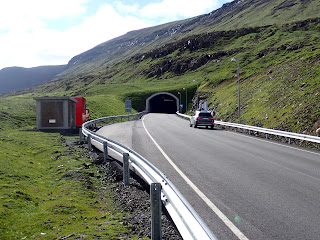
I made bus trips to Tørshavn and Vestmanhavn on the adjacent island of Stremoy to see those towns but more interestingly to see the countryside and the network of road tunnels that go under the sounds between the islands and through the hills. There are about 20 road tunnels joining the Faroe villages with more being drilled, a big investment for a small community. Danish subsidies may play a part in their proliferation. 
Tunnel entrance, Faroe


I sailed for Iceland on 13 June with south or southwest winds forecast for several days then a northwest gale later in the week. It is about 300nm from the Faroes to Iceland and I intended to use the fair south wind to get to an Icelandic port before the gale-force headwinds arrived. Norđfjörđur, about half way up the east coast of Iceland, has an easy entrance and the chart suggested its small boat harbour is well protected, so I headed there. I decided against the next port north, Seyđisfjörđur, although it is a bigger place and the terminal for the ferry from Denmark, as the small craft berths looked exposed to a northwest gale. The wind held fair and early in the morning of the third day Iceland's snow-streaked hills appeared through rents in the fog. The fog cleared as I closed the coast and I tied up in the small boat harbour early in the afternoon. 

Approaching Iceland

Customs and immigration were friendly but punctilious. Immigration was perturbed that I had entered the Schengen zone in the Faroes without having my passport stamped. How was anyone to know when my 90 days was up? It took several phone calls to Reykjavik to sort that out. The customs/quarantine officer used the old Maritime Declaration of Health, something that I have not seen for twenty years. It has six standard questions including 'Has there been an abnormal mortality amongst your rats?' I assured him my rats were healthy. 

The harbour at the head of Norđfjörđur.  Avalanche defences in the foreground.

Two days later the promised gale arrived, followed a couple of days later by another one so I was content to remain in harbour, if a little bored. The delights of the local village, Neskaupstađur, were quickly exhausted and the wet, windy weather did not encourage walking. There was another yacht in the small craft harbour, the 30 ft Elena, sailed by Björn Tegetmeyer, an interesting young German scientist. Together we scrambled up the hill above the town to look at the banks built as avalanche defences for the village and drove to Seyđisfjörđur in a rented car. Another interesting yacht arrived a few days later, Teddy from Ireland, owned by Nicolas Kats. Teddy is a stout 39ft steel ketch and Björn and I were invited aboard for a meal and yarn. 

Several large yachts stopped in Norđfjörđur while I was there, but true to their type, ignored the small yachts as being too insignificant to merit notice. This proved to be the case the whole time I was in Iceland. I was invited aboard every yacht that I met that was under 40ft and not one of 50ft or more. I thought Iceland might be free of this sort of snobbery but civilization is too close for it to have been left behind. This is in contrast to the more remote parts of the Southern Hemisphere such as Patagonia or Antarctica where the distances are greater and the seas a lot rougher. Anyone who sails there is probably a competent seaman and likely to treat anyone they meet as being one too, regardless of their boat size, budget or electronic gadget abundance. 

On 28 June I set off around the north coast of Iceland bound for the Westfjords in the northwest of Iceland. The distance is about 350nm and having waited for a fair wind I had an easy start. Two days out and north of the island of Grimsey, fog rolled in, the wind died and never returned with any force. We were north of the Arctic Circle and it was cold and clammy with enough fishing boats around to make getting sleep difficult. Drifting in those conditions had little appeal so I started the engine and for the next two days I motored when it was calm and sailed (slowly) when there was any wind at all, a tedious business. The midnight sun would have been more spectacular if it had been able to burn through the fog more often, but there were minke and pilot whales plus a couple of great whales too distant to identify and always many seabirds to watch. By the time I got to the Westfjords I was very tired because of needing to keep watch for fishing boats. 
Midnight sun north of Iceland

Pilot whales


In the Westfjords I anchored near the head of Veiđileysufjörđur and slept. Veiđileysufjörđur is uninhabited and surrounded by steep hills with a rough trail leading up towards the icecap. It is the sort of place that I would usually like, but is open to the southwest and the holding is indifferent in glacial till so I did not venture far from the boat. 

Approaching Veiđileysufjörđur


The low clouds draping the hills did not add to its appeal and two days later I sailed 33nm across the bay to Isafjörđur, the biggest settlement in the Westfjords. Isafjörđur harbour is tucked in behind an eyri, an old glacial terminal moraine and very well protected. A dozen or so yachts were crammed into the small craft harbour, rafted together on grubby pontoons. Rather than join them I anchored a few hundred metres off, well protected with good holding. It was a clean, quiet berth, but as it lacked an electric power connection and needed a dinghy to get ashore, I had it to myself. 
Westfjords 


I topped off my water and diesel, did a bit of shopping and socialised with the crews of some of the smaller yachts, particularly Teddy. The stories of Iceland's exorbitant prices are true and my shopping was limited to bread, milk, vegetables and a little meat. I do not understand how the Icelandic economy works or how prices are set, but the exchange rate seems to be artificially high. Icelandic salt cod is cheaper in the Caribbean than in Iceland, alcohol prices are too high for an honest sailor to consider and even a coffee stretched my budget. 

The ice reports still showed too much ice along the Greenland coast for a small yacht to negotiate so, after six days in Isafjörđur, I went to look at more of the Westfjords while I waited for it to clear. I sailed 30nm to anchor behind a small eyri near the head of Hrafnsfjörđur. The fjord is uninhabited and surrounded by steep hills that were still snow streaked although it was now past mid-summer. There was a constant roar from the numerous waterfalls. 
Hrafnsfjörđur anchorage. The spit is an eyri.


For two days the weather was windy, cold and bleak. I huddled by the cabin heater, reading and feeling a inadequate for not being more venturesome. When the wind eased, I launched the dinghy and went for a walk. The streams rushing down the hillside were still snow bridged, but the bridges looked too fragile to trust. The bird life was prolific. Ashore ringed plovers did their broken wing act to draw me away from their nests and there were many wheatears. On the fjord eider ducks in same-sex rafts cooed and gabbled and two whooper swans whooped. There were Icelandic/glaucous gulls (I can seldom tell the difference), a few greater black-backed gulls and guillemots, both black and Brünich's. 

Three days after arriving in Hrafnsfjörđur the wind picked up to F7, funnelling down the fjord and swinging us close to the eyri. I could have shifted closer to the head of the fjord, but would have had to move again as soon as the wind changed. Instead, I got the anchor and ran back to Isafjörđur under staysail alone. I left at 1930 and arrived at 0330 but had no difficulty navigating as there is no darkness in July this close to the Arctic Circle. 

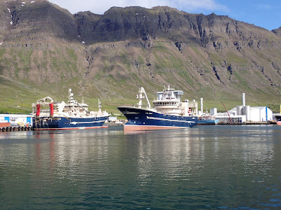
Icelandic fishing boats. The fish do not have much  chance

Back in Isafjörđur the ice charts showed the pack ice off east Greenland to be opening up but still not navigable for a yacht. A week later the ice looked as if it might be passable and the weather forecast was for six days of moderate weather followed by a nasty low-pressure system. I cleared customs, paid my harbour dues and sailed from Isafjörđur at 0600 on 22 July, hoping to make the 400nm across the Greenland Strait and through the ice into Tasiilaq on Ammassalik Ø before the low arrived. 

Once clear of the land, the breeze was northwest giving a comfortable reach, but it died before midnight. I wanted to be clear of these waters before the forecast gale arrived so started the engine. When the breeze returned, it was a headwind, puffy and variable. I was now in the Irminger Current, a warm offshoot of the North Atlantic Drift that sets north and east up the west coast of Iceland. It kicked up a small, irregular sea that slowed us down badly. Despite using the engine intermittently, our average speed was below three knots. 

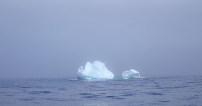
At 1510 on 24 July, the third day out, the first iceberg appeared, looming through the fog about 2nm away. We were 90nm off the Greenland coast and 200nm from Tasiilaq, in position 65°49’N, 030°56’W. I had hoped to be much closer to the coast before encountering bergy water and that the visibility would be good enough for me to find an ice-free area to heave-to and get some sleep before tackling the close pack along the coast. Meeting ice so far out and in fog dashed that hope. 
Bergy bit, sun and fog

Visibility varied from 100m to perhaps 5nm and we passed a steady stream of bergs and bergy bits. Some were very close before they appeared through rents in the fog. Although there was not enough ice to impede progress, a close watch was necessary. Heaving-to for sleep in poor visibility with that much ice about was riskier than I liked. I turned back out of the cold south-flowing East Greenland Current into the warm, relatively ice-free Irminger Current. 

Once back in open water, I hove-to and considered the matter. Getting to the Greenland coast was going to require a continuous watch for at least two days and, without someone to share the watch keeping, I was going to be very tired by the time I got there. The last part, threading through close pack near the coast, was going to be the most difficult and I would have to tackle this when I was most tired. 

One option was to heave-to for a day or two and hope the visibility improved, then try again. The gale was forecast to arrive in four days, which limited how long I could hang about. I have dealt with the combination of gale, fog and ice in the past and it is a frightening affair that I did not want to repeat. 
Watching for ice in fog. The lighter patch above the horizon centre right is blink from a hidden berg

At this point I found the bracket holding the alternator was broken due to metal fatigue. I could do without the alternator but the alternator belt also drives the engine's fresh water circulation pump. With the alternator loose I could not tension the belt which meant I could only run the engine for short periods and at low speed. The prospect of attempting to penetrate pack ice without an engine convinced me to abandon my attempt to get to Greenland. 

I tried to convince myself it was a prudent decision but it seemed more like an ignominious retreat without having given the ice off the Greenland coast a fair try. The redoubtable Tilman tried to close the coast still to near here in the pilot cutter Seabreeze with a full crew but without a functioning engine and lost his vessel in the process. His warning after losing Seabreeze that '...the lesson of this sad story is not to mess about in Greenland fjords without an engine' is undoubtedly correct, but quoting it sounds like an attempt to justify my abdication. I do not expect to succeed in every endeavour of this kind. Indeed, a perfect record of achievement is probably evidence of never having tried anything challenging, but in recent years I have become more cautious in marginal situations and as a result achieve less than I once did.

Recriminations could wait; I needed to address the immediate situation. I was about 40nm from the Arctic circle in poor visibility with ice about and there was a gale forecast. Also, I was without an engine though this was of little significance unless I was trying to negotiate close pack ice. I had no reason to return to Iceland so set a course for Ireland, about 1300nm distant. The first leg was south down the Greenland Strait for about 400nm, which would get me out of narrow waters and clear of ice. I could then alter course towards Bantry Bay, about 900nm further on. This leg might be rough at times but there would be no ice and plenty of sea room to deal with bad weather. 

Initially I sailed south with a light, fair breeze that gave slow but steady progress in fog and drizzle. The last ice disappeared into the haze at 2000 on 24 July, though I of course did not know this was the end of it. The water temperature rose 2°C which I hoped meant we were in the Irminger Current and beyond the ice. 

Two days later and 200nm further south and without having seen any ice for a day and a half, a front brought an abrupt wind shift to SW3, which put us close hauled on starboard tack. The wind increased and by 0200 the following day, 27 July, was SW6 and we were crashing along close hauled and close reefed, cold, wet and uncomfortable. To my delight the wind then veered to W5 giving a fast reach. This fine, fair wind held for a day and carried us to 60°N, the latitude of the southern tip of Greenland, where it died away to NE2. By noon on 28 July, four days after turning away from Greenland, we were out of the Greenland Strait, 400nm clear of Greenland, 250nm from Iceland and probably 250nm from the nearest ice. 

I had room to ride out a gale and could alter course to the southeast towards Ireland. I expected the rest of the passage would be straightforward, though not necessarily easy. Initially the breeze was light though generally fair, which was reflected in the next two day’s runs of 86 and 84nm. A SW4 then gave us a 106nm run. When it died away the wind that replaced it was SE6 gusting 7, a dead noser. With plenty of sea room, there was no reason to knock the gear or myself about so I hove-to and ththat day's run was only 23nm. The calm that followed this was short lived, quickly replace by a SW7, a fair wind but stronger than one would wish. I ran off under staysail only. As the barometer began to rise the wind veered to NW8, later easing to NW4; 74nm noon to noon. 
A fair wind

The next night, 4 August, was clear and starry. For the last two months the stars had been obscured, initially by 24-hour daylight and latterly by clouds, and it was good to see them again. Two days of moderate northwest wind and runs of 105 and 111nm took us to within 200nm of the Irish coast and back amongst fishing boats. There a high settled over us, bringing clear sunny weather, light airs and calms but with enough swell to set the sails slatting and crashing despite preventers, vangs, topping lifts and other rolling gear. 

I would usually douse the mainsail in these conditions and enjoy the quiet, but with no working motor and many fishing boats about I kept it up to give steerage way. The slatting was more than the mainsail’s gooseneck could stand and it disintegrated. The gooseneck was an example of the sort of thing too common on yachts, made to look good but only suitable for fair-weather sailing. I had already replaced numerous bits of highly polished, totally inadequate yachty nonsense (bow rollers, rudder head and so on) but, although it was on the list, had not yet built a new gooseneck. I lashed the boom to the mast and kept sailing. The wind remained light so my fix was never tested, which was fortunate as it looked insecure. 
Waiting on wind off the Irish coast

The light airs and calms persisted as I slowly closed the Irish coast. It took me three days to make the next 120nm, with much slatting of the sails. On 9 August a light breeze carried us the final 20nm into Bantry Bay. I anchored behind Dinish Island near Castletownbere, 16 days after turning away from Greenland and 19 days from Iceland, having sailed 1696nm to make good about 1550nm. 

Drifting into Bantry Bay

I did not go ashore as Castletownbere is not a port of entry for Ireland, but spent two days at anchor making and fitting a replacement bracket for the alternator, using material I had aboard. It was still flat calm when that job was done, but now I could motor 20nm to Bantry to clear in. 

Once the entry formalities were dealt with, I set about fabricating a new gooseneck. I had enough stainless steel plate and rod aboard for the job and the necessary tools but it would have been easier with access to a drill press and metal worker's bench. Grinding, cutting and drilling 6mm metal plate in the cockpit is messy and difficult and I am an amateur metal worker at best. I cannot generate enough power to weld aboard so I took the gooseneck parts together with my welding machine to a friend's place on Whiddy Island and welded it up there. The result was strong and functional if a bit agricultural, the antithesis of its predecessor. 

In light of my poor showing trying to get to Greenland, I decided to do something less strenuous next. On 12 September I sailed from Ireland towards the Caribbean intending to take whatever interesting warm-water diversions I could find along the way. No more ice (for now).